This is from the Plan Commission Monday night, and was an amendment during the Finance Committee Budget meeting. Here’s what the city plans to do.
If you want to follow along, here’s the video
Here’s the agenda.
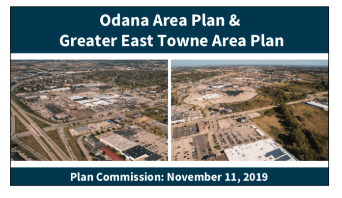
ODANA AND EAST TOWNE AREA PLANS
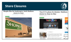
He says that nationwide there has been a rash of retail store closings, both big box stores like Shopko and Toys R Us and other smaller retailers in malls and strip malls around the country to the look at the East Towne and Odana Road areas are the city’s attempt to start responding to these largely single use areas.
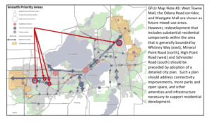
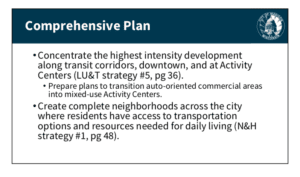
He says the comprehensive plan contemplated these actions back in 2018. One of the things in the comprehensive plan is the map of growth priority areas and the east Towne Area and West Town Area have a number of transitional centers that are single use areas right now and through the Comprehensive plan are designated to mixed use nodes. In the West Towne to West Gate area there are three centers. In East Towne there is one large regional activity center.
In particular in the West Towne area there is actually a map note on the future land use plan that specifies that an area plan process would need to be undertaken prior to being able to accommodate substantial mixed used development that includes a residential component. They know for both of these areas there is a lack of connectivity and amenities like park land that residents would expect.
The comprehensive plan has a number of goals, strategies and actions in it that speak to the necessity of undertaking planning processes like these. He says there are a few that are on the screen – he reads the following:
He says these and other strategies and actions within the comprehensive plan have instructed the thought process for selecting these areas for this planning effort. He moves on to the boundary areas.
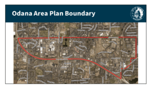
Odana runs from Research Park on the far east all the west to the interchange with Mineral Point Road and the Beltline. The southern boundary is the west beltline highway and Mineral Point Road on the northern boundary.
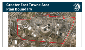
The greater East Town area plan is looking at I-90/94 for the boundary on the north, the map is skewed a little bit. The railroad tracks further to the west, Dwight Drive on the opposite side of E. Washington Ave. and then Mendota street on the South a little north of Stoughton Rd.
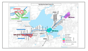
He says he wants to put the planning areas in context for the rest of the city and show their size in relation to the size of downtown. With the planned Bus Rapid Transit that is going through that process right now both of these areas kind of bookend that planned east/west BRT route and that would provide additional accessibility to these planning areas and potentially spur interest in redevelopment and infill development within these areas. As far as the importance of these areas to the city, the Downtown Areas is about 605 acres as shown on the map. East Towne area plan boundary is 786 acres and Odana areas is 1044 acres. Both of these areas, East and West have a substantial possibility of having a big impact on the city after these planning processes are undertaken.
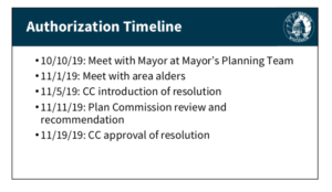
They have met with the mayor in October about this, the Mayor is a sponsor of the resolution that is in front of council, they also met with area alders in the planning area boundaries. A resolution was introduced at city council and is here before them tonight looking for hopefully a recommendation to council to approve the planning division moving forward with these processes and potentially council action next week.
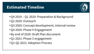 He reads the timeline slide above. He says the outreach will be with residents in and surrounding these planning areas, as well as employers, businesses, employees in the planning areas since there aren’t too many residents actually within these planning areas.
He says these will be separate plans, but proceeding side by side.
Questions and vote
None. Motion (Hagenow, Lemmer) and passes on a voice vote.
