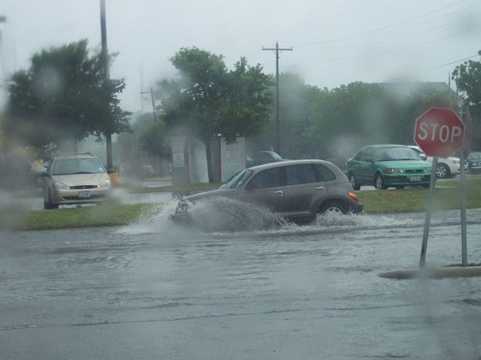
Yesterday I gave you the “nothing to see here” county version. Here’s the City’s report. Seems like they could just get together and do one report, but I guess not. City warns of flash flooding and not to park cars on the streets in low lying areas.
Severe, heavy rain expected, pressure increases on lake, river levels
The City of Madison Engineering Division will monitor the multiple rounds of showers and thunderstorms expected today into Wednesday morning. The National Weather Service reported there is a potential for flash, river and lake level flooding disruptions in the next 24 hours in southcentral Wisconsin, including the City of Madison. If the rain is as heavy as forecast, some residents are likely to experience flash flooding and/or lake level flooding and should prepare as much as possible ahead of time to remain safe.
With lake levels already high, the incoming rain could put even more pressure on the City’s stormwater system. When the stormwater system is holding so much high lake level water, there is less room to hold extra rainwater from heavy rain events, and flooding may result.
Incoming weather
The National Weather Service reports 1.75-2.5 inches of rain is forecast but locally higher amounts of 3-5 inches are possible. A few storms may produce damaging winds and large hail. If the forecast holds, the rain will continue to put pressure on river and lake levels. The added rain could also cause standing water on streets. This happens when drainage systems that discharge into the Yahara River and Lake Monona backup and cause standing water on streets.
Residents who live in low-lying areas should not park cars in areas that have a history of flooding or are at low points in the street. If flash flooding occurs, do not drive into flooded areas. Madison is under a Flash Flood Watch until Wednesday morning.
Some areas of potential concern for flash flooding include but are not limited to the intersections of:
- Blount Street at Mifflin Street
- Dayton Street at Blount Street
- Dayton Street at Livingston Street
- First Street at Johnson Street
- Third Street at Johnson Street
- Fourth Street at Johnson Street
- Livingston Street at Mifflin Street
Engineering crews will remain on standby until the threat of flooding has passed.
Residents and visitors should remain cautious when driving and should report significant flooding to City Engineering Operations 608-266-4430.
Residents should plan ahead if possible:
- Don’t drive through standing water.
- When intense rain is predicted, avoid parking in low lying areas of the Isthmus and the near east side.
- Avoid parking in other areas known to have flooded in the past.
- Sign up for weekly flooding updates.
- Know where the nearest sandbag fill locations are.
- Visit the City’s flooding website for other resources.
- Report flooding when possible on the flooding form.
It is the City’s priority to keep residents safe and keep the community connected with updates as crews continue to monitor the potential for flooding.
Full flooding report for Oct. 1, 2019:
Lake Mendota Today
Elevation: 851.00 feet
Change from one week ago: up 0.08 feet
Change from one month ago: up 0.70 feet
Above/below summer maximum: above by 0.90 feet
Above or below 100-year elevation: below 1.80 feet
Lake Mendota
Surface Area: 9,842 surface area acres
Summer Min: 849.6 feet
Summer Max: 850.1 feet
100-year Record: 852.8 feet
Historic High: 852.74 (June 6, 2000)
Lake Monona Today
Elevation = 846.98 feet
Change from one week ago = down 0.17 feet
Change from one month ago = up 0.50 feet
Above/below summer maximum: above by 1.78 feet
Above or below 100-year elevation: below 0.72 feet
Lake Monona Statistics
Surface Area = 3,274 surface area acres
Summer Min = 844.7 feet
Summer Max = 845.2 feet
100-Year Record = 847.7 feet
Historic High: 848.53 (Sept. 6, 2018)
The problem low-ground elevations in the Isthmus area are at about elevation 848.0 to 849.00. These areas rain to Lake Monona and/or the Yahara River mostly at East Washington. The closer Monona rises to 847.00 the more ineffective our drainage system in these low areas becomes at addressing high intensity storms (1″ or more per hour).
The Engineering Division will continue to send flooding updates as appropriate. Residents are encouraged to sign up for the email list and/or visit the City’s flooding website for information.


